181-190-22-00-0 HWY 14
Cantil CA 93505
$495,000
Status: Active
Description
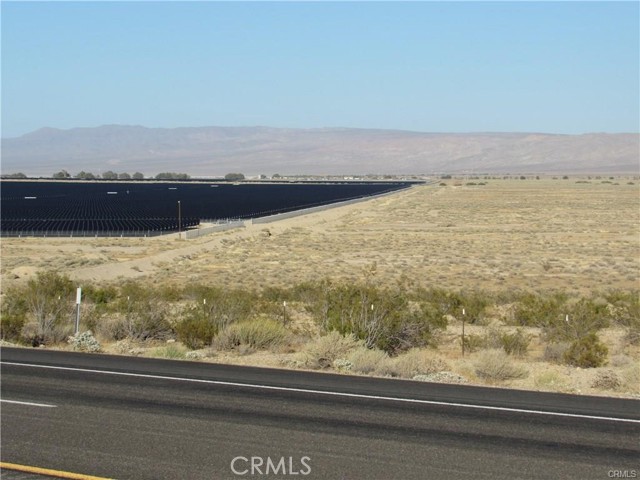
There is not an address associated with this parcel. What is reflected is the Parcel# 181-190-22-00-0 which is +/-29.58 Acres. Zoning is A-1(Agricultural). Located in Unincorporated Kern County in the area of Cinco Access via dirt Quartz Rd. Existing solar projects are adjacent. The North half of the North half of the Southeast quarter of Section 32, Township 30 South, Range 37 East, M.D.B. and M., in the Unincorporated Area of County of Kern, State of California, according to the Official Plat thereof. Excepting therefrom that portion of said land conveyed to the State of California, by Deed recorded November 12, 1929 in Book 314, Page 88 of Official Records. Also excepting therefrom that portion of said land conveyed to the City of Los Angeles, a Municipal Corporation, by Deed recorded February 18, 1969 in Book 4243, Page 921 of Official Records.
Map Location

Ed Prehoden
Broker Associate
DRE# 00954218
687 South Coast Highway #102 Encinitas, CA 92024
Get Directions
858-217-5400
Send Me a Message
DRE# 00954218
687 South Coast Highway #102 Encinitas, CA 92024

This information is deemed reliable but not guaranteed. You should rely on this information only to decide whether or not to further investigate a particular property. Before making any other decision, you should personally investigate the facts (e.g. square footage and lot size) with the assistance of an appropriate professional. You may use this information only to identify properties you may be interested in investigating further. All uses except for personal, non-commercial use in accordance with the foregoing purpose are prohibited. Redistribution or copying of this information, any photographs or video tours is strictly prohibited. This information is derived from the internet data exchange (IDX) service provided by Sandicor®. Displayed property listings may be held by a brokerage firm other than the broker and/or agent responsible for this display. The information and any photographs and video tours and the compilation from which they are derived is protected by copyright. Compilation © 2024 Sandicor®, Inc.
© 2024 Team Prehoden - All rights Reserved.
Powered by: